Tuesday, August 30, 2016

State Of the Map - Brussels

I'll be at State Of the Map this year in Brussels.  SOTM is running from September 23 through the 25th.

Apparently purple is the thing this year.

This is something of a convenient detour.  We're heading to the Meteorological Technology World Expo that next week in Madrid.

I've got a table and I'll be showing off the usual stuff.  Given the crowd, I'll lean more on the map apps.

If you're going to be there, drop by and say hello!

Wednesday, August 24, 2016

Announcing WhirlyGlobe-Maply Imagery Pro

Today I'm delighted to announce the first option on top of the WhirlyGlobe-Maply toolkit: Imagery Pro.

The red's moving away so that's good.

Up to now everything has gone into the free toolkit or client apps.  This marks the first time we're keeping something to ourselves and, yes, charging for it.

Who's This For?


We love all our users equally.  Okay, maybe we love the ones who pay support a little bit more.  But you're all cool.  Honest.

We've attracted a lot of weather and aviation users.  It makes sense.  They have pretty serious data display needs and only a passing interest in street maps.

Imagery Pro is for them.  We're taking what we've learned and pushing way beyond.

What's In It?


It's all in the marketing, but the basics are like so:

  • Efficient data transport
  • Fancy shaders
  • Getting rid of the !#*$& seams
  • Easier particles
I do love my animated gifs

All good stuff if you do weather and/or aviation.

So what about WhirlyGlobe-Maply?


That's right.  My five year plan to give away massive amounts of geospatial code is finally coming to fruition!

But no, the base toolkit is all good.  Imagery Pro is about expansion into a couple of markets that want much more right now and they're willing to pay for it.

We're continuing to expand WhirlyGlobe-Maply with iOS (2.5) and Android releases in the pipeline.  That's not going to change.

Thursday, August 18, 2016

Build System

We've wanted a more formal build system with WhirlyGlobe-Maply for quite some time.  Thanks to José we've finally got one!


Nightly and on-demand builds are now available!

Binary Versions


It turns out not everyone wants to build the toolkit from source every time.  Weird, right?

So for those strange people we've had a binary distribution.  You can see it linked off the main site and it got updated... you know... sometimes.  Well now we're doing better.

If you go to the Builds tab on the WhirlyGlobe-Maply site you'll see this.


That's the filtered output from our Jenkins server, a Mac Mini sitting in the corner of my office.  I expect it to last several years before filling up with dust and catching fire.

You can just use the binary framework directly on iOS.  On Android it's an AAR file with every frickin' architecture.

Binary Cocoapod


If you're a Cocoapods user the iOS zip files contain a Podspec.  That makes it a self extracting Pod.  To use it, all you have to do is this.


If we've pointed you at a specific feature build, you just use the URL for that one.

Continuous Integration


We're also triggering builds for commits to certain branches.  For now that's just develop_2_4_1 (aka version 2.5) and develop_3_0 (Android).  We'll add more as we go.

This is nice internally and it's already caught a few commit mistakes, but we plan to go further. The goal is to hook up our test apps and run them on attached Android and iOS devices.

All this work was done under the guise of WhirlyGlobe-Maply support.  You support customers paid for it.  Thanks!

Monday, August 1, 2016

Deprecating Mapbox GL Style Sheet Support

For an update on the situation go read the latest.  Short version:  We're putting it all back.

If you follow the open source mapping world (and why would you?), there's been some interesting rumblings about Mapbox Intellectual Property of late.

I don't totally understand this, but Mapbox is unhappy with the stated goal of copying Mapbox Streets.

Is Mapbox Wrong?


Legally, I haven't a clue.  Ethically, they're probably quite right.  Their participation in the community earns them the benefit of the doubt.

So then, if we take them at their word, the word is "Thou shalt not copy Mapbox Streets".

It's an interesting word and it kicked off a bit of examination of my project.  Am I using any Mapbox IP and what are the consequences?

Mapbox Now and Mapbox Future


Is this really a big deal?  Mapbox is a good open source citizen and they're clearly trying to be very gentle.

But here's the thing, Mapbox took venture capital.  A sale is a likely outcome and those people aren't going to be as nice.  Think Oracle and Java.

So, what Mapbox IP do we use and what should I do about it?

Mapbox Vector Tiles


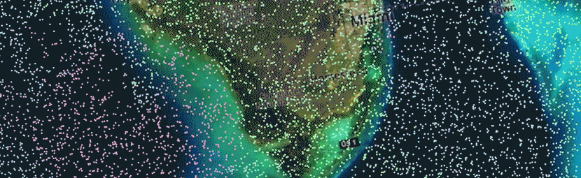
My users do use vector tiles.  Some Mapbox hosted, but always their own custom data.  Some users even have their own services.  Both cases are fine.

Vector tiles are undeniably open.  They've stated so any number of times and data formats are well understood in IP law.  I think we're good there.

Mapbox GL Style Sheets


This one's dodgier.  Though the format itself is open, there are restrictions on the style sheets we can use.  I can follow those restrictions, but will my users?  Ha!

Most open source users consider anything publicly available to be fair game.  The Mapbox Streets styles are the best out there.  There's no way they won't borrow from them.

So now we've got a style format that's tempting you to cheat.  That's strike one.

Data formats encode technical thinking.  If I implement OpenGL ES shaders to support Mapbox GL Styles then how different are those from Mapbox's own shaders?  It's a question that gives me pause.  That's strike two.

Goodbye to Mapbox GL Style Sheets


The style sheet format is cool, but it's too dangerous.  I'm ripping it out of the toolkit for version 2.5.  If you're using it, grab the code and make your own copy.

We do have Styled Layer Descriptor format support coming out soon.  Not as cool, but a nice safe OGC standard.